Yangtze River backdrop
Entity Profile

Yangtze River

长江
Place Level 1 — Concrete The Way of Nature Atlas ↗ #river #waterway #civilization #yangtze-basin

The Yangtze River (长江, Cháng Jiāng) is the longest river in Asia and the third-longest in the world, flowing 6,300 kilometers from the glaciers of the Tibetan Plateau in western China to the East China Sea near Shanghai. It has been the lifeblood of Chinese civilization, supporting agriculture, transportation, and cultural exchange for millennia.

Place
primary type
Level 1
Concrete entity
10
relationships mapped
Overview

About Yangtze River

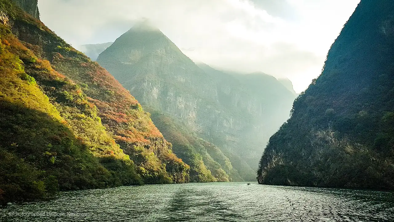
The Yangtze River (长江, Cháng Jiāng, meaning 'long river') stretches 6,300 kilometers from its source in the glaciers of the Tanggula Mountains on the Qinghai-Tibetan Plateau to its vast delta at the East China Sea near Shanghai. It is Asia's longest river and the world's third-longest. Its course passes through an extraordinary array of landscapes — from high-altitude Tibetan grasslands through the deep gorges of Yunnan, the Sichuan Basin's red hills, the Three Gorges (三峡, Sanxia), the fertile lakes and plains of Hunan and Hubei, and finally the densely populated delta. The river originates in Yunnan province at its upper reaches, where the headwaters begin their long descent.

The Yangtze Basin spans nearly one-fifth of China's land area and supports an enormous diversity of ecosystems. In its upper reaches, alpine meadows and conifer forests give way to temperate broadleaf forests in the middle reaches, and subtropical wetlands in the lower basin. The river's floodplains, lakes (including Poyang and Dongting — China's largest freshwater lakes), and wetlands are vital habitats for countless species. The Yangtze is related_to lotus (莲花, lianhua), which grows in its wetland shallows, and to rice, as the basin is China's primary rice-growing region. Mulberry groves (桑树, sangshu) line the river's banks, supporting sericulture. The river is also related_to the giant panda, whose habitat extends into the Yangtze basin.

The Yangtze has been the central artery of Chinese civilization for over 5,000 years. Its waters have enabled the transport of grain, tea, silk, and porcelain between the interior and the coast. The region south of the lower river is called Jiangnan (江南, literally 'south of the Yangtze'), and the river is related_to jiangnan as its defining geographical feature. The river is related_to sichuan, through which it flows, to mount-tai in the broader context of China's sacred geography, and to yunnan as the source of its headwaters. The Yangtze River Delta is one of the world's great economic zones, where the river's alluvial gifts have built one of the most densely populated and productive regions on Earth.
Relationship Network

How Yangtze River connects

Each relationship represents a meaningful semantic link between Yangtze River and other entities in the Atlas knowledge graph.

Entity Constellation

Entities connected to Yangtze River

These entities share semantic relationships with Yangtze River in the Atlas knowledge graph.

Naming

Also known as

Yangtze River (synonym) 长江 (synonym) Changjiang (synonym) Yangzi Jiang (synonym)
Atlas Role

Yangtze River in the Atlas

What this entity provides

The Yangtze River (长江) is the Atlas's central geographical artery—Asia's longest river, flowing 6,300 km from Tibetan glaciers to the East China Sea. Its basin spans nearly one-fifth of China's land area, supporting the earliest rice cultivation (8000-6000 BCE), the sericulture of Jiangnan, and the tea mountains of Yunnan. The Yangtze connects Place to Place (jiangnan—'south of the river', sichuan, yunnan), Plant (lotus, mulberry, rice), Animal (panda), and Artifact (silk, porcelain transported along its waters).

What it does NOT duplicate
  • jiangnan (江南)—the region south of the Yangtze, not the river itself
  • yunnan (云南)—through which the Yangtze's headwaters flow, not the river itself
Subsite References
dao-of-seasons

The Yangtze's seasonal flooding patterns defined the agricultural calendar of central China for millennia.

missing-umami

The Yangtze basin produces the rice, soybeans, tea, and fish that form the foundation of East Asian umami cuisine.

atlasofheritage

The Yangtze has been the central artery of Chinese civilization for over 5,000 years—transporting grain, tea, silk, and porcelain.

Sources & References

References for Yangtze River

Visual Gallery

Yangtze River in imagery

Yangtze River — visual reference
Watch

See Yangtze River in motion

Amazing Places on Our Planet · 2.8M views · YouTube ↗

Yin's Travel · 460K views · YouTube ↗

Owner Site

The Way of Nature Atlas

Central Atlas — provides Overview pages for all entities. Does not produce original entity content, only aggregates and references.

ConceptCraftMountainRiverFestival